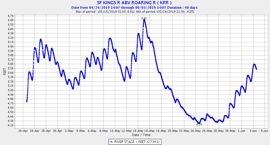
Gauging Station: SF KINGS R ABV ROARING R
ID: KRR
LATITUDE: 36.786958°
LONGITUDE: -118.616571°
LOCATION: Along the South Fork of the Kings River, upstream from the junction with the tributary Roaring River.
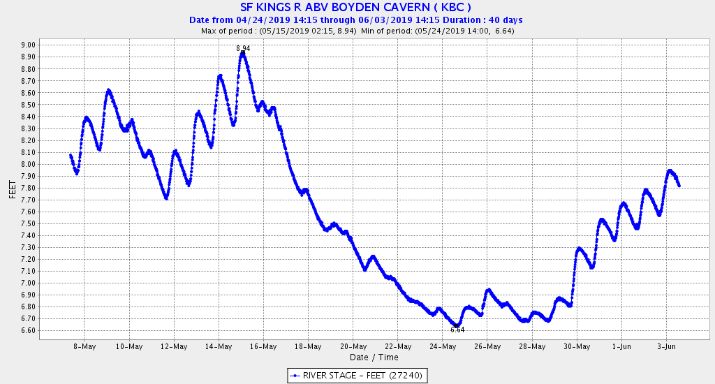
Gauging Station: SF KINGS R ABV BOYDEN CAVERN
ID: KBC
LATITUDE: 36.80889°
LONGITUDE: -118.77806°
LOCATION: Along the South Fork of the Kings River, upstream from Boyden Cavern.
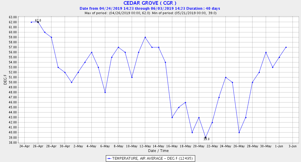
Gauging Station: CEDAR GROVE
ID: CGR
LATITUDE: 36.788°
LONGITUDE: -118.659°
LOCATION: Along the South Fork of the Kings River, at the Cedar Grove Village.